America’s roadways are changing, and so are the tools we use to manage them.
Across the country, transportation agencies are deploying LiDAR and other sensing technologies to gain sharper insight into traffic patterns, anticipate risks, and act before incidents occur. The result is a new era of roadway management – one built on data, collaboration, and a commitment to safer streets for everyone.
That shift underscores a crucial truth: data-driven, multi-sensor systems are moving us beyond reactive responses toward predictive, preventive management of our streets.
LiDAR in Action: Nashville’s Vision Zero Push
During a recent session of the ITS America webinar series STV helped organize, we heard from clients about LiDAR – short for Light Detection and Ranging – uses laser pulses to map environments in 3D, giving agencies a sharper view of vehicles, cyclists and pedestrians in motion – without collecting personal information.
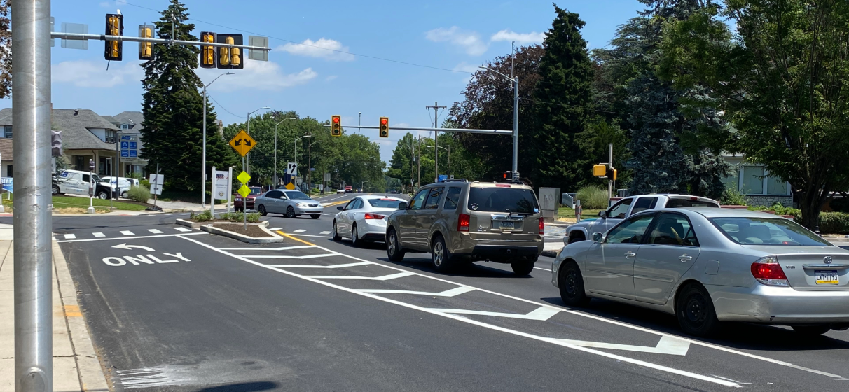
For the City of Nashville, LiDAR has become a cornerstone of its Vision Zero strategy. Along busy corridors like Clarksville Pike and Broadway, LiDAR sensors are helping city officials understand travel behaviors across modes.
- On Clarksville Pike, deployments revealed previously invisible crossing patterns that led to the installation of new mid-block crosswalks.
- On Broadway, which can see 20,000-30,000 visitors on a weekend night, LiDAR data is helping monitor sidewalk congestion, alert officials when pedestrians spill into traffic and guide adaptive signal control.
Crucially, this data is collected without capturing personally identifiable information – anonymity and safety work hand in hand.
Video and LiDAR: A Complementary Pair
While LiDAR delivers granular object detection, AI-powered video analytics add another layer of insight. Derq, for example, is helping cities like Nashville analyze near-misses, track vulnerable road users and assign “safety scores” to intersections.
The combination of LiDAR and video allows transportation leaders to understand where conflicts are occurring and predict pedestrian intent at crossings – triggering alerts or adjusting signals before a collision occurs. Together, these tools allow agencies to act before an incident, not after.
Scaling Solutions Across States
At TxDOT, engineers adapt similar analytics across their existing camera networks to detect wrong-way drivers, stranded vehicles and pedestrians on high-speed roadways. In a recent pilot, video analytics identified more than 500 pedestrians walking along a seven-mile highway stretch – data now being used to deploy life-saving interventions.
As TxDOT expands the program from nine cameras to more than 70, the results are precise: scalable, cost-effective sensor networks can immediately impact public safety.
Building the Roadways of Tomorrow
The lessons are the same from Nashville’s entertainment corridors to Texas highways. LiDAR, video, and AI – when combined – create a powerful toolkit for:
- Proactive safety: identifying risks before they result in crashes.
- Operational efficiency: guiding adaptive signal timing, transit signal priority and crowd management.
- Data-driven decision-making: helping agencies prioritize investments where they will deliver the most significant impact.
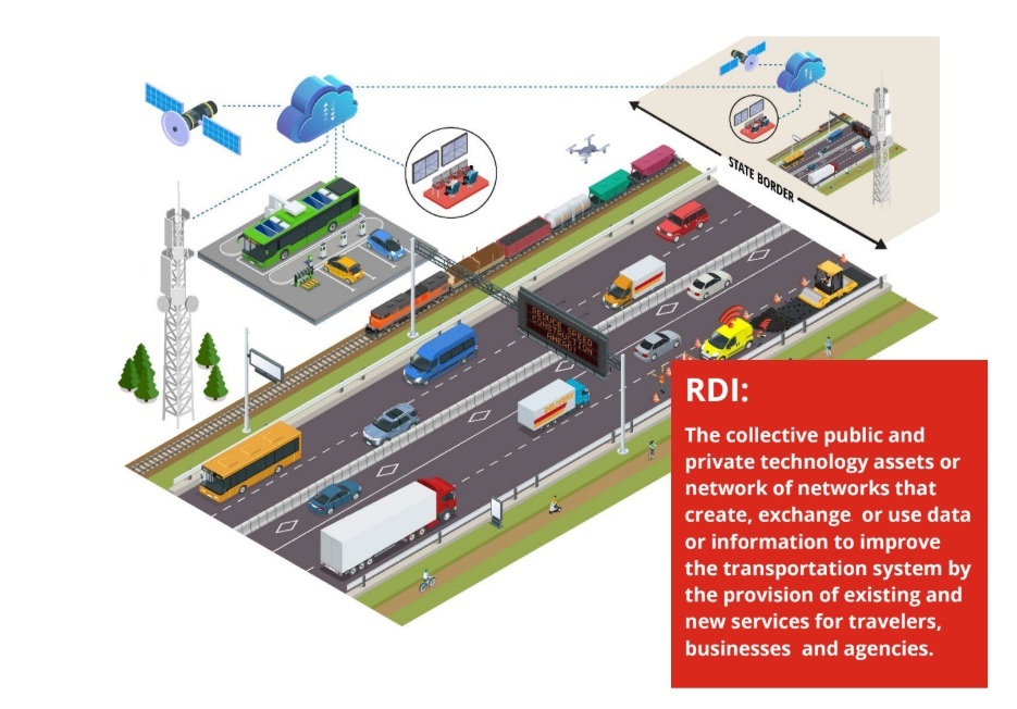
These systems for Roadway Digital Infrastructure (RDI) also support emerging needs – from protecting first responders to preparing for autonomous and connected vehicles – so our infrastructure evolves alongside new modes of travel.
STV’s Role: At the Table and In the Field
At STV, our Mobility Technologies team is proud to participate in this national conversation while also working with agencies to integrate these solutions into real projects. By leveraging our technical know-how, industry partnerships and on-the-ground experience, we help clients move from pilot programs to full-scale deployments.
The future of mobility is about building networks that are more connected, adaptive, and human-centered. By harnessing technologies such as LiDAR, STV helps agencies turn insight into action – creating meaningful improvements for the communities they serve.