In an increasingly digital era, Geographic Information Systems (GIS) technology is redefining how STV’s project teams are approaching infrastructure development across the United States. From highways to transit systems, GIS is no longer a tool solely for mapmaking but a comprehensive technology for visualizing, analyzing and interpreting data spatially.
As digital consumers, we increasingly favor visual content – think Instagram stories and infographics – over text-heavy reports. As we reflect on the advancements made in GIS within the AEC industry on the 25th GIS Day, we recognize how this technology aligns with this current trend. GIS is turning data into visual stories that help stakeholders understand project dynamics without needing to read dense documentation. That’s because the best maps are those without words, where the visual layout alone conveys key information. From a bird’s-eye view of a city’s transportation network to a close-up of a floodplain, GIS-based maps and models speak a universal language.
A Shift to Visual and Spatial Understanding
Gone are the days when rolled-out paper plans and dense spreadsheets dominated construction sites. Today, digital tools – especially GIS – reshape how we visualize and interact with project data. Instead of sifting through technical reports, engineers and stakeholders can view project details on tablets, explore interactive maps and access data dashboards. This shift to spatial visualizations is invaluable in civil engineering, where projects often cover large geographic areas, impacting both the physical environment and the surrounding communities. GIS maps, for instance, can make complex project dynamics intuitive, offering a real-time, visual understanding of how various factors, from traffic patterns to environmental constraints, interact.
Enhancing Project Analysis and Decision-Making
GIS technology enables planners to conduct advanced geospatial and statistical analyses, delivering insights that might be lost in text or tables. For example, on a recent project STV supports for the Florida Department of Transportation (DOT), we used GIS to analyze truck traffic and its spatial impacts on a new parking facility.
On other STV projects, our GIS team has set up dashboards that allow engineers and clients to visualize the impact of construction, all while tracking metrics like ADA compliance, pedestrian traffic flow and the effectiveness of construction phasing. By offering our clients fully customized dashboards, we can leverage GIS technology to help them understand crucial project information, predict future challenges and make data-driven decisions that reduce costs and risks.
Modeling Real-Life Scenarios for Better Planning
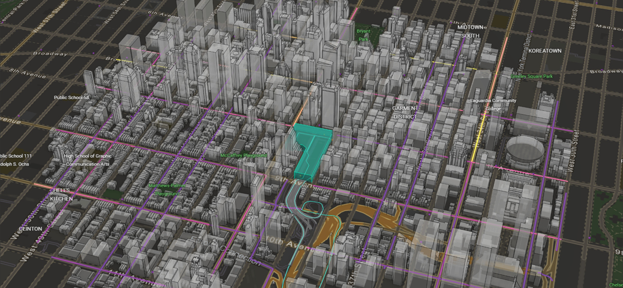
In preparation for large-scale events, such as the upcoming Los Angeles Olympics, GIS plays an essential role in venue and transit planning. With GIS modeling, planners can simulate arena capacity, predict pedestrian flow and model transit pressures.
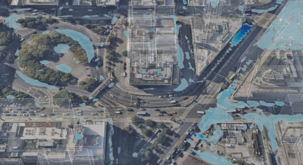
Beyond facility planning, this technology has the ability to visualize different scenarios – like a “1,000-year flood” or high tide conditions – to provide planners with invaluable insights that can mitigate risks.
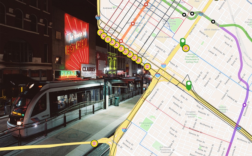
GIS is also instrumental in tracking land acquisitions, right-of-way developments, and project milestones. For example, with a recent BRT (bus rapid transit) program we are planning, we leveraged GIS for right-of-way tracking. This allows our planners to better visualize the acquisition process, helping to ensure transparency and streamline workflows.
Creating a Seamless Connection Between People and Places
Infrastructure projects inevitably impact the environment, and GIS is invaluable for assessing and mitigating these effects. At the heart of civil engineering is the goal of connecting people to the places around them. This connection is best understood through the spatial lens that GIS provides. By mapping out the relationships between people, places and environmental factors, GIS makes it possible to plan projects that truly enhance community connectivity. For instance, by analyzing pedestrian traffic flow, transit systems can be designed to encourage walking, biking, or public transit use, ultimately contributing to healthier and more accessible urban spaces.
Looking forward, GIS technology will continue to transform infrastructure development, pushing the boundaries of what’s possible in project planning and execution. Its applications are virtually limitless, with each new project revealing more potential for GIS to enhance our understanding of spatial relationships. By enhancing our ability to visualize, analyze and interact with project data, GIS is paving the way for a future where infrastructure not only serves people’s needs but does so in harmony with the surrounding environment and community.